 9 4 1/4 x 15 1 1/8 (284.4 x 460.3 cm)
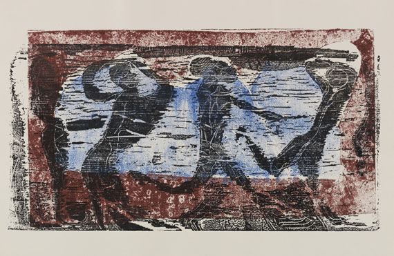
Thomas Scheibitz. Map I (Old Map). 2003-04
托马斯·谢比茨。地图I(旧地图)。200304-
9 4 1/4 x 15 1 1/8 (284.4 x 460.3 cm)
Thomas Scheibitz. Map I (Old Map). 2003-04
托马斯·谢比茨。地图I(旧地图)。200304-

材质 :
图片文件尺寸 : 6319 x 3832 px
Atlas der neuesten Geographie-Atlas der neuesten Geographie., 1830.
最新地理地图集-最新地理地图集。,1830

材质 :
图片文件尺寸 : 4859 x 3695 px
Karte des Elbstromes-Karte des Elbstromes innerhalb des Königreichs Sachsen, 1855.
易北河地图-1855年,萨克森王国易北河地图。

材质 : Colored copper engraving
图片文件尺寸 : 6257 x 5459 px
Asien-5 Bll. Karten aus Berghaus\' Atlas von Asia., 1832.
亚洲-50亿。博格豪斯《亚洲地图集》中的地图。,1832

材质 :
图片文件尺寸 : 6287 x 4342 px
Nuovo atlante portatile-Nuovo atlante portatile. 1785.
新便携式地图集-新的便携式地图集。1785

材质 :
图片文件尺寸 : 4325 x 4756 px
Johann Baptist Homann-Sammelatlas mit 86 Karten., 1725.
约翰·巴普蒂斯特·霍曼-包含86张地图的集体地图集。,1725

材质 :
图片文件尺寸 : 5709 x 4092 px
Homann Erben-Atlas von Deutschland (Sammelatlas). 90 Karten. 1753 ff.
霍曼继承人-德国地图集(集体地图集)。90张卡。1753及其后。

材质 :
图片文件尺寸 : 4859 x 3695 px
Johann Baptist Homann-Großer Atlas (Fragment mit 24 Karten), 1716.
约翰·巴普蒂斯特·霍曼-大型地图集(包含24张地图的片段),1716年。

材质 : Colored copper engraving
图片文件尺寸 : 4859 x 3695 px
Landkarten-Sammlung-Sammlung von 45 Karten, dabei: Duval, Atlas universel des sciences, um 1620-1800.
地图收藏-收集了45张地图,包括:Duval,Atlas universal des sciences,约1620-1800年。
下载收集了45张地图,包括:Duval,Atlas universal des sciences,约1620-1800年。-地图收藏大图

材质 :
图片文件尺寸 : 6454 x 4462 px
Wilhelm II.-Konvolut: Wilhelm II., Eitel-Friedrich (Brief u. Karte), Blomberg (Karte), Schrirach (2 Briefe)., 1924.
威廉二世。-Konvolu:威廉二世,Eitel Friedrich(字母和地图)、Blomberg(地图)、Schirach(2个字母)。,1924
下载Konvolu:威廉二世,Eitel Friedrich(字母和地图)、Blomberg(地图)、Schirach(2个字母)。,1924-威廉二世。大图
材质 : Portfolio
图片文件尺寸 : 4859 x 3695 px
Mappe I-Mappe I (Hrsg. von H.-P. Schulz). Mit Graphiken von G. Altenbourg u. a., 1969.
地图I-《地图I》(Ed.von H.-P.Schulz)。1969年,G.Altenbourg等人绘制的图形。
下载《地图I》(Ed.von H.-P.Schulz)。1969年,G.Altenbourg等人绘制的图形。-地图I大图

图片文件尺寸 : 5250 x 3868px
迪克·凯特的《男女地图》-Dick Ket
Man en vrouw kaartend--Dick Ket (荷兰, 1902 – 1940)


